It is estimated that there are currently the same number of navigation receivers on Earth as humans. Positions, navigation and time signals from space-based constellations such as Galileo and GPS form an invisible, indispensable infrastructure that lays the foundation for many modern aspects of modern life (communication, energy, and transportation).
Satellite navigation is helping to control more and more planes, ships, trains and self-driving cars. At the same time, navigation-based time stamps can mark real financial transactions worth billions of euros and coordinate the synchronization of the grid. Satellite navigation is always active and available anywhere on the planet. Therefore, it is easy to take usability for granted. These signals from space are equally important, and they are also susceptible to ground interference.
Andreas Lesch of OHB Digital Solutions in Austria said: “It’s just a matter of output power.” “The navigation signal on the ground corresponds to the light of the 60-watt lamp on the satellite. For Galileo, its distance in space is about 23,222 kilometers. These weaker signals may be accidentally or deliberately destroyed by stronger local radio signals or even misleading false navigation signals (so-called deception).”
“We have developed a new GNSS interference detection and analysis system, GIDAS, to protect critical infrastructure from damage or deception by continuously monitoring important signal frequency bands. In this way, GIDAS can trigger alarms in real time, determine the nature of the failure, and then determine the cause of the failure. The location of those dangerous portable devices so that the authorities can take immediate remedial measures.”
Although at least three stations are required to locate interference sources connected to the entire monitoring center, GIDAS can provide interference detection and orientation through a single reporting station. Monitoring centers can also be connected to each other, which makes the GIDAS system easy to expand, from ensuring a single port, airport or key location of the system to the entire city or region.
Although at least three stations are required to locate the interference source connected to the entire monitoring center, GIDAS can provide interference detection and orientation through a single reporting station. (Photo: ESA)
“People are only catching up with the severity of this problem now,” Andreas added. “In parts of Europe, the highest density surveys show about three to four signal jammers per hour.
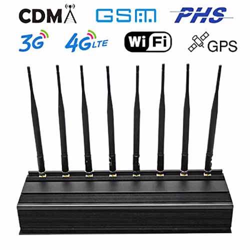
These small devices are technically illegal, but can be purchased online for a few hundred dollars or less, and are usually sold as data protection devices. The sales range of the jammer is only a few meters, but the actual use range may reach tens of meters or more, which may cause unnecessary widespread interference. For example, the famous American truck driver takes the jammer while sailing at Newark Airport as long as he passes. Will shut down the system.
